
Madeira’s Ancient Laurissilva Forest Remains Stable as Agricultural Land Shrinks by Half
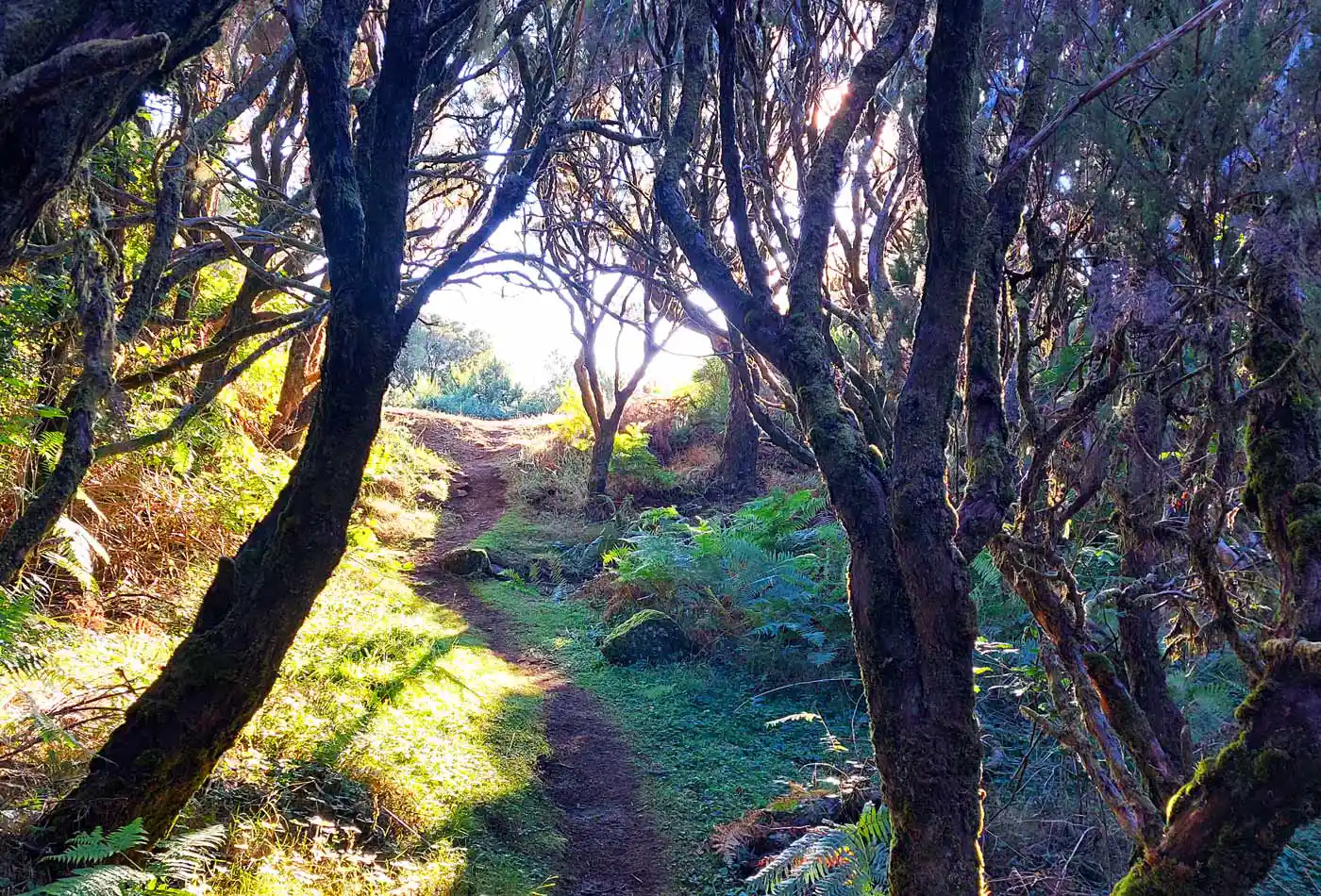
The unique Laurissilva forest, a UNESCO World Heritage site and a crown jewel of Madeira’s natural heritage, has maintained a consistent footprint over the last 17 years, according to IFRAM3. The Third Regional Forest Inventory is the 2026 scientific audit of Madeira’s forests, commissioned by the Institute of Forests and Nature Conservation (IFCN).
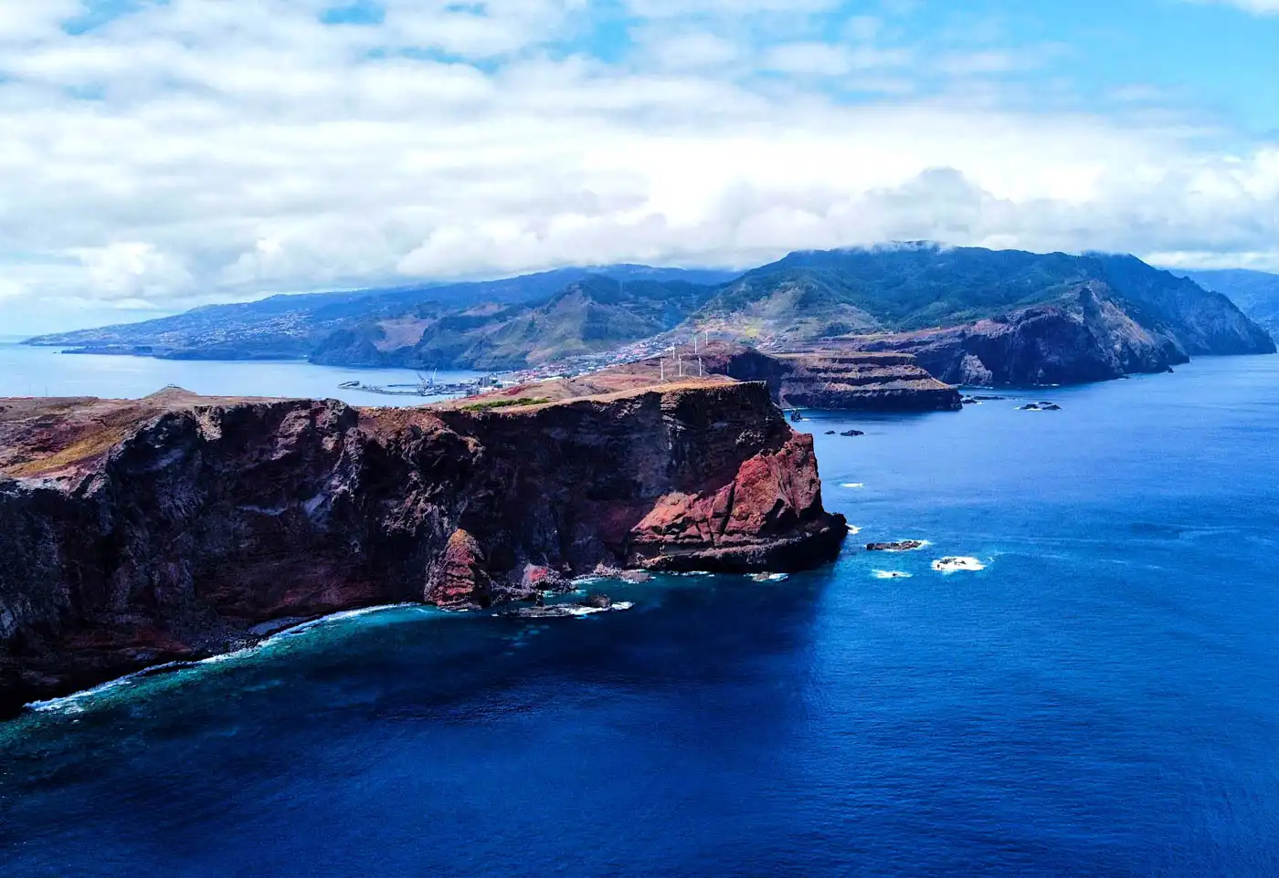
IFRAM3 indicates that 37,539 hectares of the total area of the autonomous region (48%) are occupied by forest and other wooded areas, divided between 16,440 hectares of natural forest (44%) and 19,579 hectares of cultivated forest (52%), while urban land use occupies 7,290 hectares (10%) of the island of Madeira.
Land Category | 2008 Area (ha) | 2025/26 Area (ha) | Change |
Laurissilva | ~15,500 | 16,440 | +6% |
Agriculture | 12,000 | 5,211 | -57% |
Total Wooded Area | - | 37,539 | 48% of Region |
According to the study and despite global environmental pressures, new data from the third Regional Forest Inventory shows that the heart of the island’s ecosystem remains largely intact, even as other parts of the landscape undergo rapid change.
We are now on the third inventory. The first was produced in good time in 2008, the second in 2015, and this one in 2025. This allows us to conclude that there has been work that is continuous over time and has a scientific depth that gives us confidence to better understand and make better decisions
Eduardo Jesus, Regional Secretary for Tourism, Environment, and Culture, RTP Madeira
Forest Experts Argue 16.440 Hectares of Laurissilva Stayed Stable Since 2008
The latest environmental audit reveals that Madeira’s natural and cultivated forests now cover nearly half of the island’s 78,000 hectares. Of this green expanse, 16,440 hectares are identified as Laurissilva. Professor Francisco Castro Rego, a leading consultant for the Forest Inventory, noted that the core of this ancient forest has shown "quite high constancy."
Specifically, 13,133 hectares remained strictly classified as Laurissilva between the last two inventories (2008-2025). This stability is seen as a victory for local conservation efforts, as the Laurissilva forest serves as a vital water catchment system and habitat for endemic species found nowhere else on Earth.
Why the Laurissilva Area Technically Increased from 15,500 to 16,440
The "6% increase" noted between the baseline of roughly 15,500 hectares (the historical UNESCO figure) and the new 16,440 hectares is attributed to two factors in the IFRAM3 report:
Improved Mapping Precision: The 2026 inventory used high-resolution satellite imagery and over 12,000 photo-interpreted points, allowing experts to identify pockets of natural forest that were under-counted in 2008.
Natural Expansion: As agricultural land was abandoned (dropping by 50%), the Laurissilva naturally began to reclaim its historical margins in areas that had been undisturbed by fire for over a decade.
The report shows an increase in the order of 6%, which means the Laurissilva is alive and expanding.
Eduardo Jesus, JM-Madeira
Inventory Shows 98% of Natural Forest Remains in Excellent State of Conservation
The health of the forest is as significant as its size. Official results indicate that 98% of the natural forest is in excellent condition. This high percentage suggests that the native vegetation is resilient against external threats. However, the data also highlights small but notable shifts on the edges of the woods.
Forest Statistics in Madeira 2008 and 2015
Statistics according to https://foreststats.pt/variavel/439 - the 2025 stats were not available yet at the time of writing. Chestnut likely was not yet taken into consideration in 2008.
Species | 2008 Volume (thousands of m3) | 2015 Volume (thousands of m3) | Trend (%) |
Eucalyptus | 2,008 | 1,391 | -30.7% |
Maritime Pine (Pinheiro-bravo) | 1,512 | 1,034 | -31.6% |
Acacia | 424 | 281 | -33.7% |
Chestnut (Castanheiro) | 0 | 140 | +100.0% |
Persistent Struggle Against Invasive Species
Approximately 425 hectares of former natural forest land transitioned to Eucalyptus, while another 375 hectares were overtaken by Acacia. While these numbers are small compared to the total forest area, they indicate a persistent struggle against invasive species that compete with native flora for space and resources.
While the forests remain steady, the rural landscape of Madeira is transforming. The inventory reveals that the total area dedicated to agriculture has fallen by almost 50% over the last decade. It translates into a loss of 6,789 hectares of active farmland since 2008. This sharp decline in farming has led to a significant increase in "mato" or wild scrubland.
As farmers leave their plots, spontaneous herbs and bushes move in. Experts observed a general decline in White Pine (Pinheiro Branco), while Eucalyptus and Acacia plantations saw increases. The shift from managed farmland to unmanaged scrubland presents new challenges for land management and fire prevention across the archipelago.
Government Invests 68,000 Euros to Monitor Forest Changes Through 2026
The regional government views these scientific findings of IFRAM3 as essential tools for future policy. The third inventory was conducted over a full year and required an investment of over 68,000 euros, funded by the Recovery and Resilience Plan (PRR). The Forest Inventory is a vital statistical tool used by European regions to monitor biodiversity, carbon sequestration, and the risk of forest fires, helping to align local policies with international climate goals.
Sources: Sapo.pt, RTP Madeira, Agroportal.pt, JM-Madeira


Comments